Published on:
22 June 2022
Share this:
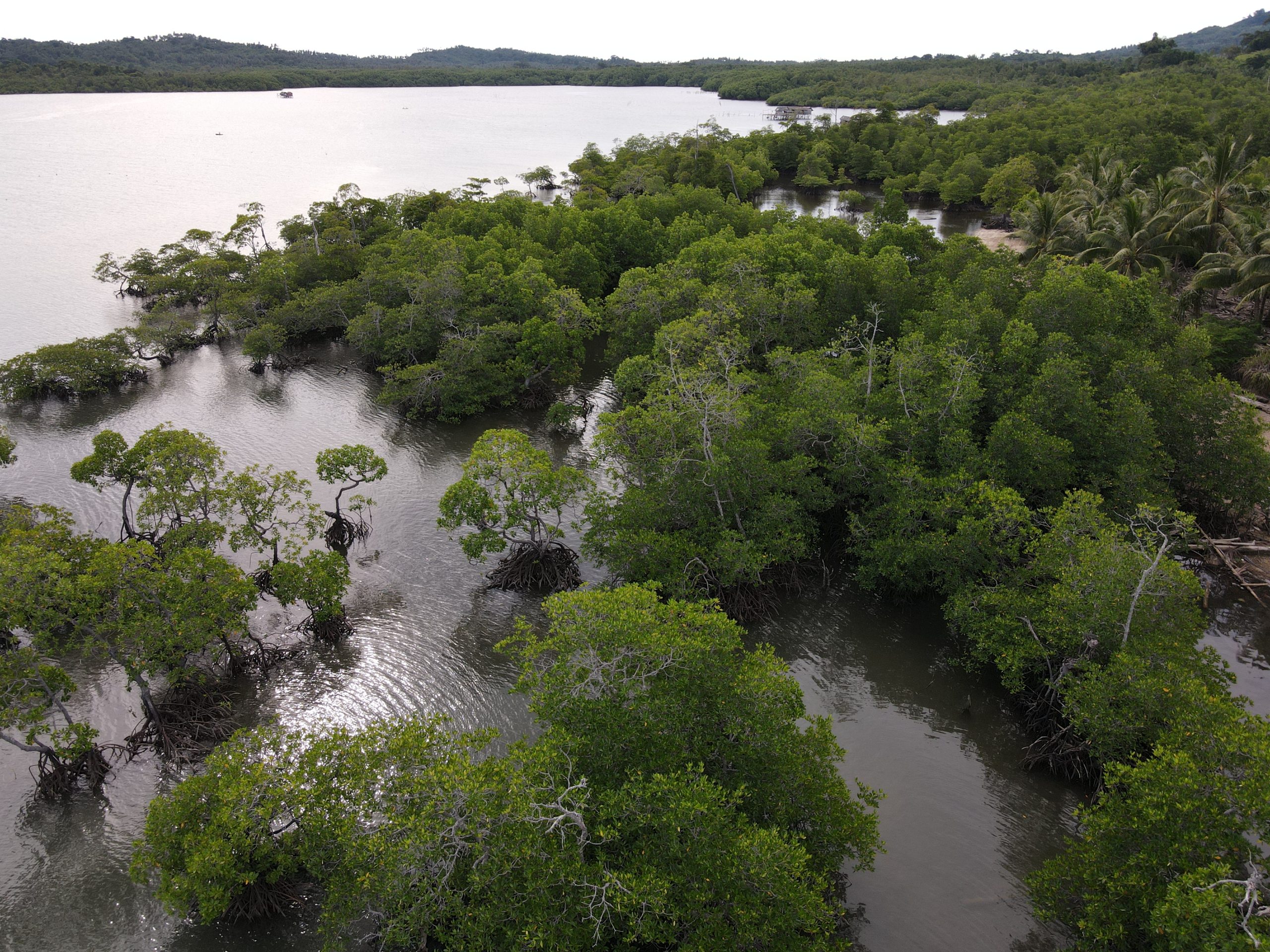
Banner photo: Meeting with various stakeholders within the multisectoral effort of vulnerable area identification.
Francisco Fuentes is a Disaster Risk Management Specialist at the Guatemala Institute for Climate Change Research (ICC). He joined a Flood Green Guide training in the summer of 2021. We sat with him to learn about the role of the ICC in disaster management and the use of nature-based solutions for flood risk reduction in the country.
What is the Institute for Climate Change (ICC)’s role in flood risk management? What are the steps that you generally follow for a flood risk management project?
We focus on the scientific part, particularly on the evaluation of risk. We do not implement projects, but we work as advisors for organizations who do. In the case of flood management, we generate knowledge products based on a hydrological analysis: we develop models to be able to identify impact zones and possible flood areas. With that data, we generate proposals for flood mitigation measures that take into account the characteristics of the area. We are a non-profit organization, so our products are available to any sector or institution that needs this type of work.
We work a lot on the risk analysis side of things but there are gaps related to the issue of social vulnerability. We are working to incorporate this aspect more, for example, through developing cost-benefit analysis studies that consider the socioeconomic benefits that the project will bring to the community affected.
In addition to the development of technical studies, we are also involved in an emergency committee that coordinates actions and needs from different stakeholders (community, municipal and central government) and allows us to better direct aid to the sectors and communities that need it most, while at the same time, avoiding duplication of efforts. We have also played a very strong role in intersectoral technical roundtables, which have allowed us to work in a coordinated manner in planning and decision-making for flood management.
Do you promote the use of nature-based methods for flood management in ICC’s projects and in your region?
Our institute has existed for 11 years, and since it started we have made proposals that include nature-based solutions. For example, after we carried out a risk analysis for two watersheds in Escuintla, we included mitigation measures that involved engineering with nature. The results from that project were better than expected: it was possible to limit the risk at those locations and as a result, the partner organization we worked with on that project began to incorporate engineering with nature-based solutions into their own projects (Fig. 1, 2 and 3).
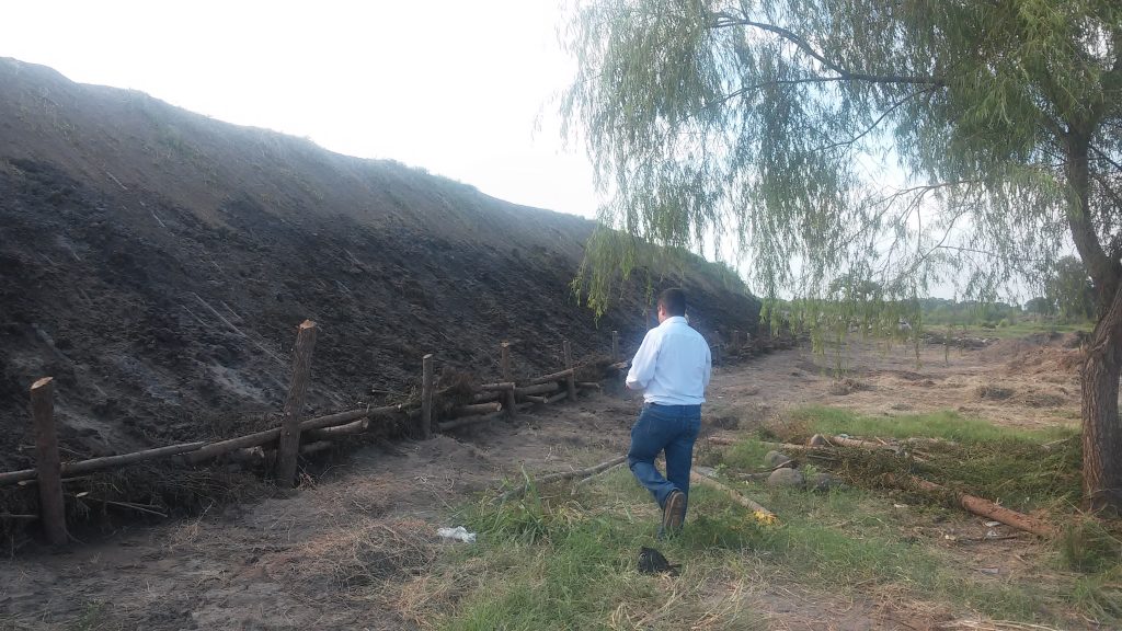
Figure 1: Prior to a mitigation project, a retaining wall using nature-based techniques is shown in the River Coyolate watershed, Nueva Concepción, Escuintla.
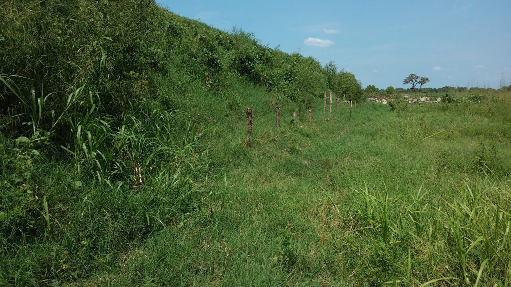
Figure 2: After a mitigation project, a retaining wall using nature-based techniques is shown in the River Coyolate watershed, Nueva Concepción, Escuintla.
At the ICC, we have also worked a lot on landscape restoration. The approach we take is to view the whole watershed as a single area. That is, we look to implement measures in the upper watershed, such as riparian forest restoration projects and the creation of buffer zones, that result in a better distribution of runoff water and prevent erosion.
Unfortunately, there are still certain doubts in some sectors and amongst some decision-makers about these alternative nature-based methods for flood mitigation. At a social level, I think there are still some doubts about their effectiveness. At a political and economic level, there is a tendency to prioritize traditional engineering projects rather than opting for alternative measures based on nature, even though in the end, the latter can be much cheaper and have better long-term results. We still need to raise awareness and promote spaces where we can exchange experiences in order to change mindsets around these topics.
Which actions do you think we should prioritize to reduce existing barriers to nature-based methods?
We need to have open spaces for dialogue — spaces for technical support to learn about how nature-based methods work — because in many cases we are totally unaware of them. The space we had at the Flood Green Guide training was very valuable because we saw that these projects are viable and, in many cases, they are extremely practical and low-cost compared to traditional methods. But we need to be able to generate those discussion spaces and strengthen the capacities of decision makers to generate a broader map of existing solutions. Through these discussions, we come to understand that floods can be managed with a mix of methods, using both gray infrastructure projects and nature-based methods.
Have you noticed a change in the frequency or intensity of floods in Guatemala compared to past events? How are you integrating uncertainty, for example related to climate change, in the flood management process at the ICC?
Yes, definitely. It is evident that due to climatic variability that there have been changes in the annual patterns of the two main seasons in Guatemala. We have experienced multiple rain events that are highly concentrated in a short period of time, and that have an extremely high level of impact in the lower watershed. It is clear that the weather pattern has been altered.
Regarding uncertainty, we address it through monitoring stations and historical records to be able to predict and establish trends. We have a network of stations (37 strategically located meteorological stations), from the highlands to the coastal zone. We also have hydrometric stations to measure river flows and generate projections and modeling to be able to predict certain patterns. However, certain processes have been altered so much that two rainy season patterns may be completely different, which has made this process much more difficult.
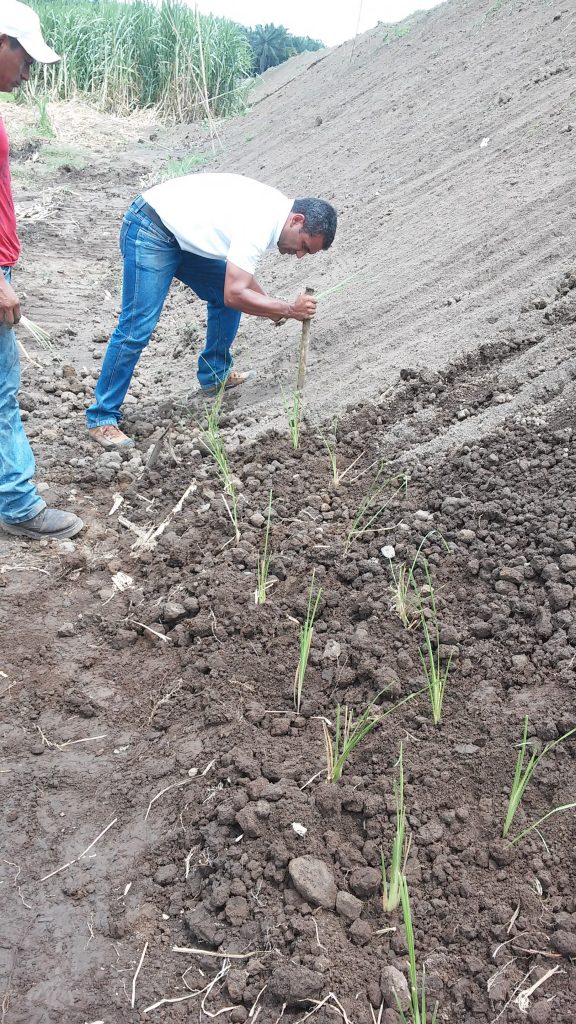
Figure 3: Implementation of a retaining wall based on engineering with nature techniques in the Coyolate River watershed, in Nueva Concepcion, Escuintla.
Which tools and concepts did you learn in the training that will be useful for your work? How are you planning to apply those?
I loved getting to know the Flood Green Guide methodology, and I see it as extremely flexible to be able to work on risk-related research projects, but one of the things that caught most of my attention was understanding the landscape as a single interconnected space – a concept very related to our work. It is something that at the local level and at the government level is still not fully addressed. We have not yet implemented comprehensive actions from the upper part of the watershed to the lower part.
Also, something that is going to help me a lot personally, is to be able to consider the social component and integrate it into the risk assessment process. Many times, this aspect is omitted in research and risk analysis work. In fact, this year I started working on the social analysis part for a specific watershed and I already have my methodology thanks to the Flood Green Guide!
One of the most valuable things about the guide is that we can adapt it to projects we are working on. In fact, in one of our projects we recommend the Flood Green Guide as a tool that can be very useful for managing not only floods, but risk in general. We are also participating in a dialogue table in the coastal area where we want to strongly promote this methodology.