Published on:
21 April 2022
Share this:
Key Concepts and Foundational Knowledge
Who is the primary audience of Flood Green Guide?
The Flood Green Guide (FGG) is an open-source guidebook and training program. Although the approach and methods can be applied from the national to household levels, the primary target audience is mid-level government, NGO, and technical agencies.
What is the watershed perspective used by Flood Green Guide (FGG)?
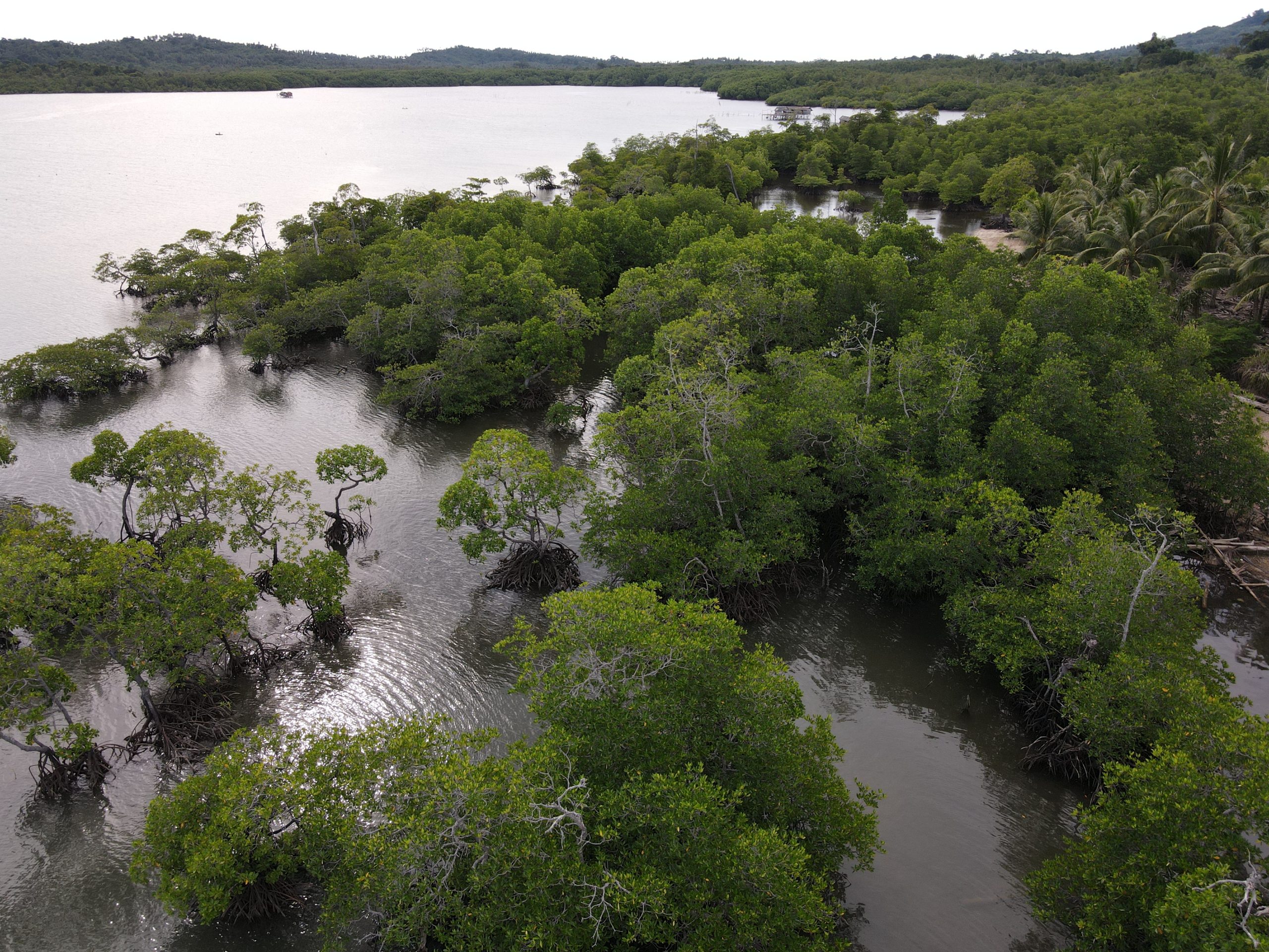
The Flood Green Guide (FGG) recommends taking a watershed approach to Flood Risk Management by considering all aspects of the watershed such as biophysical, social, environmental, development and risk-related parameters.
How can the boundaries of a watershed be defined?
Sometimes referred to as drainage basins or catchment areas, a watershed consists of surface water and the underlying groundwater and is an area of land that drains down slope to the lowest point. Organizations like the United States Geological Survey and HydroSHEDS use elevation data to map watershed boundaries. Because watersheds follow geography instead of jurisdiction, there can be political issues that play a role in how some boundaries are defined. One community’s work to reduce flood risk could shift that risk to a different community. Therefore, it is essential for governments to address floods through a watershed-level approach.
What are scales of risk and why are they important to Flood Risk Management (FRM)?
People’s perceptions, vulnerability, and flood impacts differ depending on the scale of risk. There are four scales considered in the FGG: Watershed scale, Flood Plain scale, Community scale and Household scale. Some believe that nature-based approaches can only be done at the watershed scale, but we believe that even at the household level, nature-based FRM methods can help reduce risk and provide co-benefits. Some small-scale methods can be scaled up to community or floodplain levels. Understanding how households vary in capacity and vulnerability is important to FRM.
Community Engagement and Stakeholder Involvement
How can communities be empowered and engaged in flood risk management? What is the appropriate participatory platform?
The issues associated with flood management should not be separated from the needs of a community. Proper flood risk management must include proactive community engagement.
It is critical to decide the appropriate level of community engagement and why you are engaging with the community. Are you simply sharing information or are you seeking equal participation and decision-making to truly co-generate flood management? Just as there are different objectives for community engagement, community engagement methods can take many different forms, ranging from large public forums to soliciting feedback online via surveys. One way to listen to the range of perspectives in a community is to intentionally seek input from a range of community members, especially those who may not hold positions of power (e.g. are not active volunteers or do not have close links with governmental or non-governmental organizations). That includes, but is not limited to, engaging marginalized and underrepresented groups.
How can we better engage government authorities who are often the ultimate decision-makers on flood policy?
It is important to engage collaborators, experts, and other stakeholders for maximum impact on influencing decision-makers and governments.
Usually, the small “working groups” involved in the initial assessments or design of flood risk management projects are not the ultimate decision-makers. They inform and influence the political agencies and higher bureaucracy, which make the final decisions. Working groups most often include experts and community leaders, and should seek support and collaboration with stakeholders from related sectors. With a strong and diverse network, there is a better chance of engaging policymakers and positively influencing government decision-making.
Sometimes referred to as “Advocacy Coalitions,” these networks have like-minded experts, organizations, and activists that may work together for years to positively guide policymakers down certain paths. This approach can be useful in mainstreaming nature-based methods of flood risk management, where policies may historically favor hard-engineering approaches.
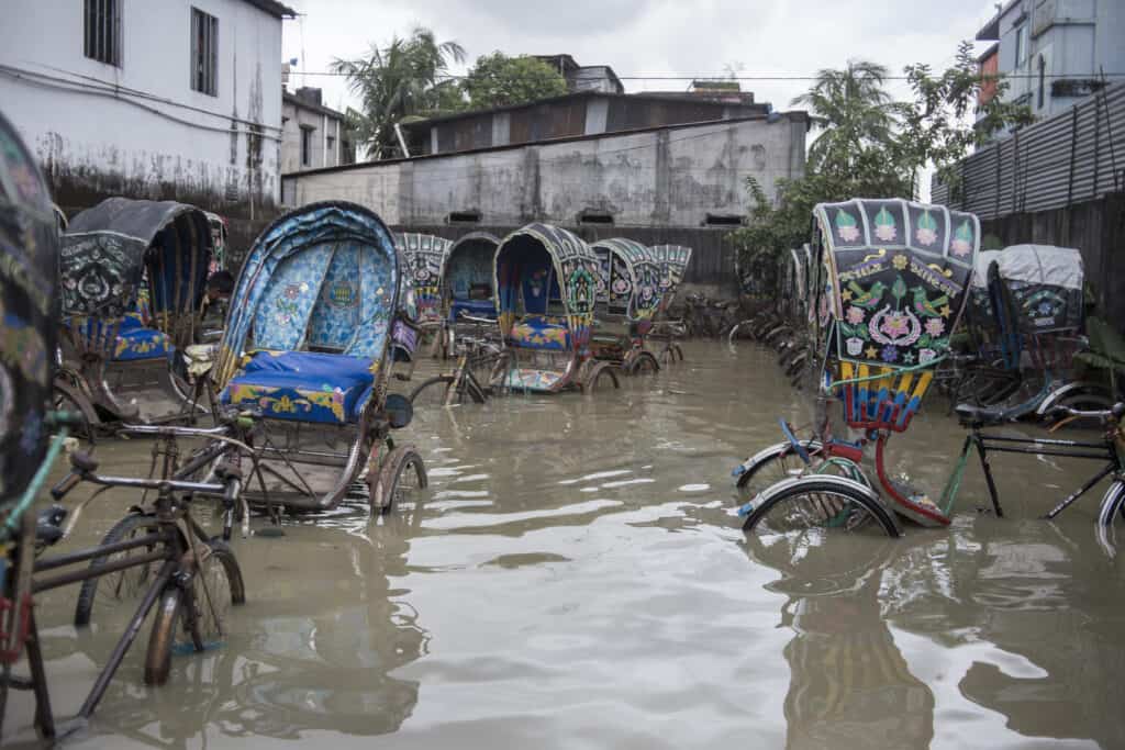
Rickshaws in tidal floodwater, in Chittagong, Bangladesh.
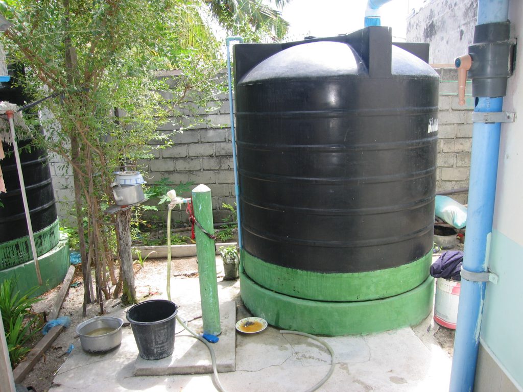
A rainwater collection system in the Maldives. Rainwater collection is a soft structural flood management method.
Assessing Flood Risk: Data, Methods, Analysis, and Objectives
How can flood risk climate data be obtained when data is limited or unreliable?
Accessing and applying climate data and modeling to flood risk can be a challenge. It’s important to understand the scale and uncertainty of climate models. Observed data and local trends can be incorporated into FRM decision-making when available. There can be useful climate-related data collected by different organizations for other purposes, which can be acquired through collaboration and accurately interpreted.
Should objectives be quantitative or qualitative? How do you evaluate qualitative objectives?
Any objective chosen should be measurable in some way, and whether that is quantitatively or qualitatively should be selected within the context of the project. Sometimes a comprehensive qualitative evaluation may provide better holistic insights into the performance of an objective than a simplistic quantitative measurement. Quantitative data can be important, but more often a combination of both can help you reach better conclusions.
Qualitatively evaluating the objectives could be done by conducting social surveys across multiple stakeholder groups to capture and aggregate their assessments of perceptions of the objective. Another option is to use a combination of ethnographic research methods, such as stories or focus group discussions, to evaluate the impact of the objective. Evaluators may also use a mix of quantitative and qualitative parameters to arrive at an assessment of the performance of an objective.
Structural and Nonstructural Methods
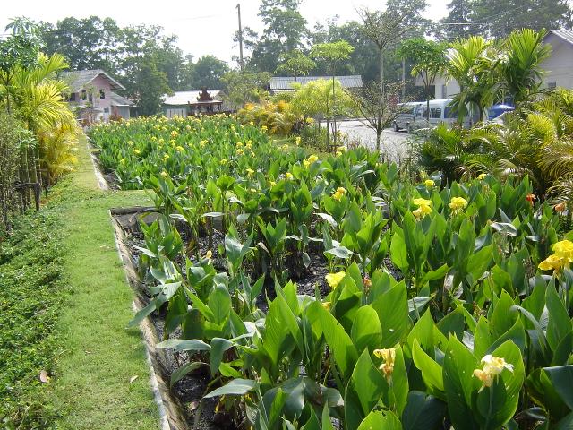
What vegetation can be used in soft structural methods?
Types of vegetation for soft structural methods will be region and site-specific. Experts should examine slope, soil type, and other aspects of the local ecosystem, and integrate local knowledge to ensure the choice of vegetation is appropriate.
Parameters to consider include species selection, project design and installation, and monitoring and evaluation of natural vegetation. It is important that prior to implementation, a survey of the pre-existing vegetation is done to determine which species used to be there. Depending on the situation, native or non-native species can be beneficial. Any type of invasive species should be strictly avoided. Most countries maintain invasive species lists identified for different eco-regions. It should be noted that not all exotic species are invasive, and native species can become invasive under certain environmental conditions and pressures. Evaluation of future impacts should be taken into account to minimize the negative effects of invasive species.
There are numerous published guides and web-based resources for plant selection for soft structural methods. The suitable plant types change widely according to the method used. For example, a terrestrial plant used for soil bio-engineering will not be suitable for wetland restoration and will die quickly in a high moisture environment. Therefore plant selection guidelines should be carefully followed, and final selection should be in accordance with the methods used. Expert advice should be sought as needed.
Can sudden events, such as flash flooding, be appropriately addressed with soft-or non-structural methods?
Flood managers must plan for events in the short-term and longer-term, and understand what risks the community faces. Vulnerability is the susceptibility to be negatively affected by something. Not everyone experiences a hazard the same way, and vulnerability can change across contexts and over time.
In the city of Colombo, Sri Lanka, over a century of hard engineering along the Kelani River has created unpredictable flash flooding. These methods may have alleviated some risks from smaller, annual riverine floods, but now larger flash floods cause massive damage on a seasonal basis.
The FGG promotes understanding the watershed comprehensively instead of trying to stop flooding at a given location or point.
How can riverbank erosion be addressed?
Riverbank erosion is a complex issue that often arises from factors beyond the immediate location of the erosion. These factors can include excess flow or energy in the stream, deficiency of sediment carried by the stream, and structural instability of the banks. Bank erosion is a natural process necessary for floodplain dynamics and health, but too much erosion is not good.
The first step in addressing bank erosion is to determine if it’s caused by an imbalance in water flow or sediment deficiency. If erosion is occurring as a part of the natural river process, it should not be controlled unless absolutely necessary (e.g. to protect an urban area).
If an imbalance is the cause of bank erosion, then it should be addressed in the flood risk reduction plan. In most cases, large-scale runoff management methods such as upper watershed restoration are useful. Next, it can be helpful to stabilize riverbanks at the site of erosion using nature-based methods such as riparian habitat restoration. Hard engineering methods such as revetments should be considered as a last option to control excessive erosion, as these methods can have negative impacts on lateral connectivity of the river and wildlife migration.
Constructed wetlands in Phang Nga, Thailand. Constructed wetlands are a soft structural flood management method.
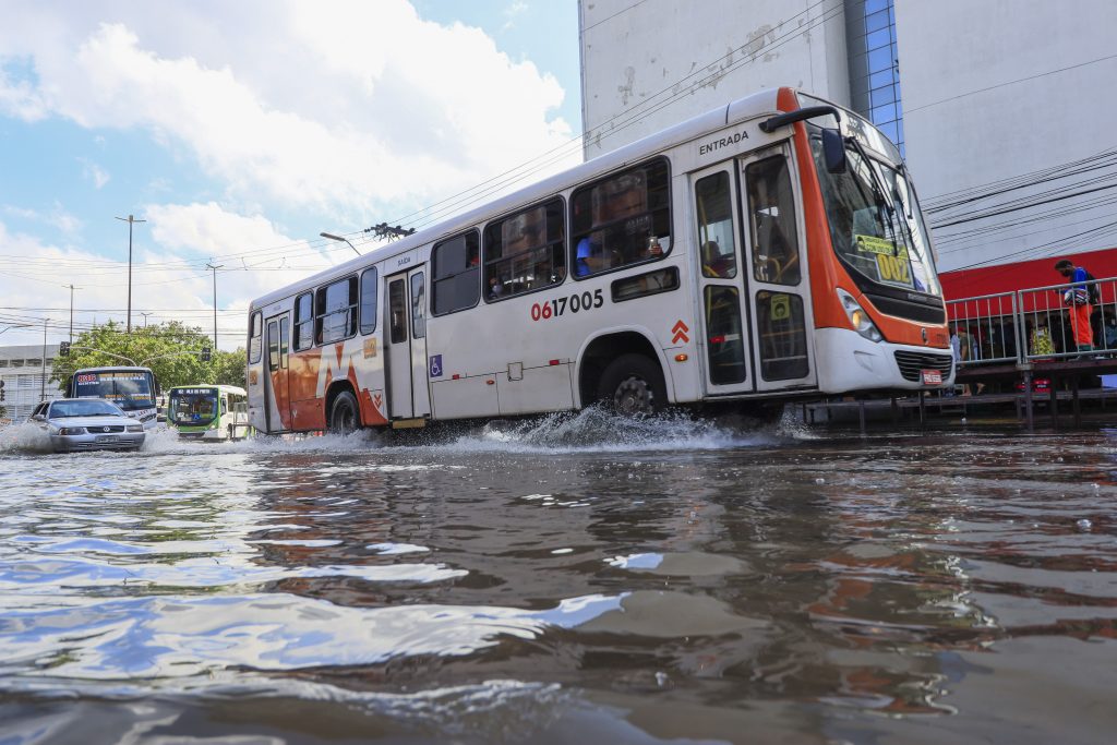
A bus is surrounded by floodwaters at Floriano Peixoto Avenue, in Manaus, Brazil.
Monitoring and Evaluation
How do you choose the optimal number of parameters to evaluate? How do you evaluate the community scale in addition to the watershed scale?
Any type of monitoring will involve a cost, and a big challenge may be securing the necessary resources and data. In the planning stage of a project, monitoring and evaluation of objectives and parameters must be considered so they are integrated into the project appropriately. During a flood, continuous watch at a local level is critical to provide updated information. At the community scale, flood monitoring can look like documenting water levels at a particular location on the river, identifying blocked drains and ditches, and noting inaccessible areas. At the watershed scale, it may be helpful to partner with environmental management agencies and NGOs because they will likely be able to support those efforts. In many cases, these organizations are already monitoring similar parameters and could have data to share.
Do you have thoughts on participatory monitoring, in which community members monitor their own activities?
Participatory monitoring and evaluation allow for the intended beneficiaries of a project to set indicators for success. This type of system includes a wider range of stakeholders and is beneficial in a variety of ways: 1) it can address resource limitations, 2) it helps build a sense of ownership for the project among communities, 3) it can improve scientific understanding within communities about flood risks and flood risk management methods, 4) and it can facilitate the exchange of local and Indigenous knowledge between community members and flood managers.
How do you address development occurring in the floodplain?
“Development” must first be defined, as well as the scale of a project. Is it an individual taking action, a company constructing a new building, or a major infrastructure project implemented by a government agency? At any scale, development projects should integrate environmental impacts into their plan. Larger projects may need to complete an impact assessment before they are given the go-ahead, and smaller individual projects may need to obtain environmental clearance from local governments as part of the construction permit.
Many land-use and water management decisions are done in a political context. Therefore, addressing local policies, building code changes, and flood preparedness programs are ways to address development that may put a community more at risk of flooding. Both environmental and risk management concerns should be mainstreamed in urban and regional planning and decision-making.
What are examples of successful flood risk management in urban areas?
There are many examples of successful flood risk management projects in urban areas. Some common methods in areas with high impervious surfaces are swales, rainwater harvesting, stormwater ponds, permeable pavement, and green streets or alleys. Below are a few examples of different scales that you can explore further.
Market at Colonnade – Raleigh, North Carolina, United States
The Market at Colonnade was a retail project located on a small site that didn’t have space to accommodate traditional stormwater management devices like surface stormwater ponds or wetlands. Developers installed three rainwater harvesting cisterns above and below ground to collect runoff and use it for toilet flushing and landscaping. A grass-lined bioretention area and bioswale capture and treat runoff from the parking lot. An underground detention chamber also temporarily stores up to 350,000 gallons of rainwater.
“Grey to Green” Meishe River project – Haikou, Hainan Province, China
To address pollution and flooding in the Meishe River, “grey” civil engineering measures, such as reducing pollution sources and developing comprehensive sewage and water treatment infrastructure, were undertaken in conjunction with nature-based, ecological infrastructure. Nature-based methods that were implemented included replacing concrete flood walls with an eco-friendly riverbank, reconnecting walled-off waterways to the ocean to allow tides to re-enter the city; and reconstructing wetlands and shallow shores along the river so that mangroves could rehabilitate them.
Resilient Semarang – Semarang, Indonesia
In an effort to reduce the risk from tidal flooding, flash floods, and sea-level rise, the coastal city of Semarang has developed a resilience strategy that involves various nature-based solutions for flood management such as rainwater harvesting, planting vetiver grass to prevent landslides, rehabilitating mangroves to protect coastlines, and developing early warning systems for floods.
Rogue River – Grants Pass, Oregon, United States
A bioengineered, stacked geocell wall was constructed by the US Army Corps of Engineers’ Portland District, to protect the city’s water supply from the Rogue River’s eroding banks. The bioengineered retaining wall provides structural protection, increases internal soil strength, and fosters the development of diverse vegetation. This is similar to what would normally cover a natural riverbank, providing habitat for wildlife.
Narborough Flood Management – Narborough Bog, England, United Kingdom
In the wet woodland of the Soar River, scientists have felled trees to lay on the ground in a way that blocks the route of floodwater and retains water in the area for longer. This recharges the peat soil in Leicestershire, which has suffered from drying in the past. All of the materials for the project were sourced within the site, and structures were hand-built to avoid damage to the ecosystem.
For additional information on the Flood Green Guide or questions pertaining to Flood Risk Management, please contact us at [email protected].